Mapping
DigiRotor have experience of mapping large areas of land to a high level of detail and accuracy. Our mapping can either be delivered as a stand alone deliverable, or used with Canopy - our in house mapping, annotation, and environmental insights system.
If you are interested in finding out how we can help you, contact us today.
Goodbye satellite maps
Google Satellite maps are free, but their resolution is very low, and they can be many months out of date.
Our maps offer improved detail compared to Google Maps and other satellite maps, as well as reflecting the most up-to-date situation on the ground. This allows you to see a much clearer picture of the site and plan more accurately.
Identify environmental concerns and risks
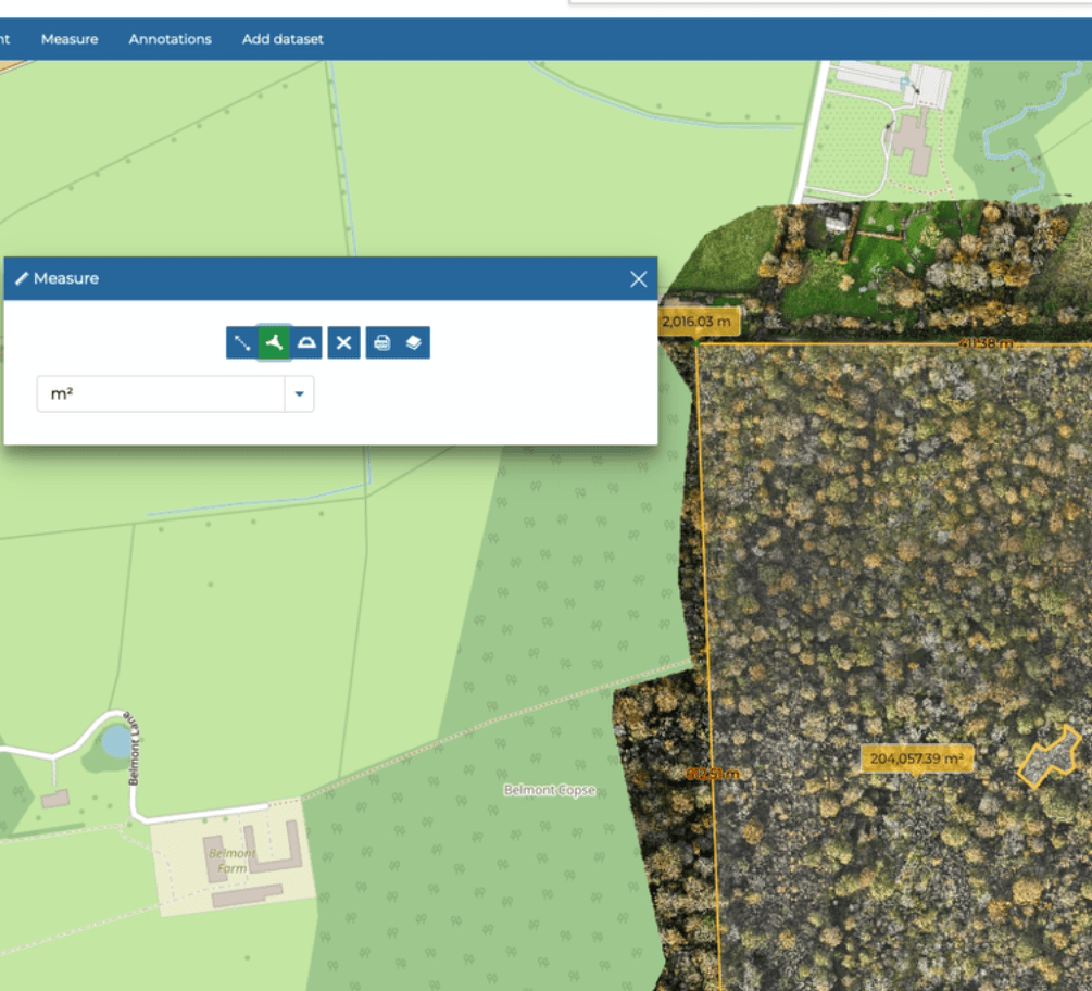
Our maps can be used to identify environmental risks without the need to visit site. If you also make use of Canopy, you can share these maps, annotations and notes with others quickly and easily
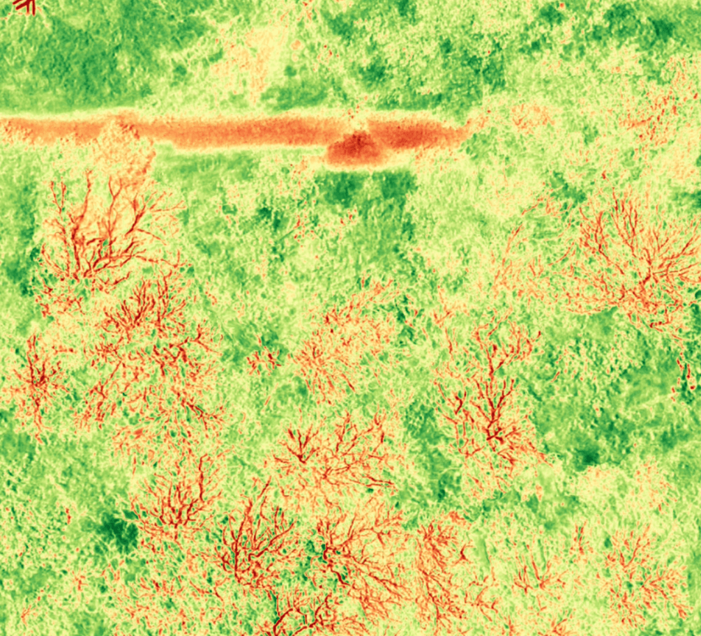
Our multispectral technology can give you an "at a glance" view of the health of plants and trees.
Save time and money
Our maps allow you to save time and money. in multiple ways.
One example is helping onsite teams to hit the ground running, reducing the amount of time they spend navigating sites and finding specific locations or features on site.
Simple & Fast
We can deliver maps within hours of the images being taken by our fleet of in house drones. This is a turnkey solution, which means you need no infrastructure or software in order to use our services.
You tell us where you'd like to map, and we will take care of the rest!
Compare mapping detail
Take a look at the difference between freely available satellite images (Left - highest quality) and DigiRotor maps (Right - medium quality)
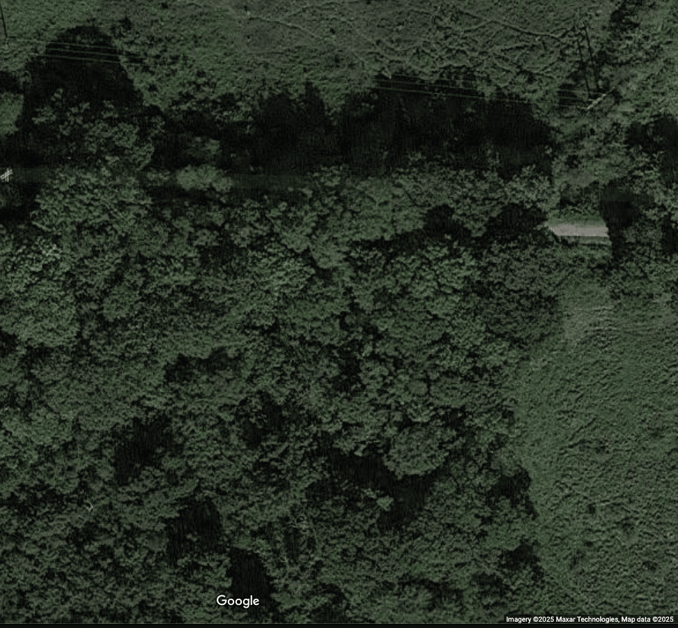
Google Maps
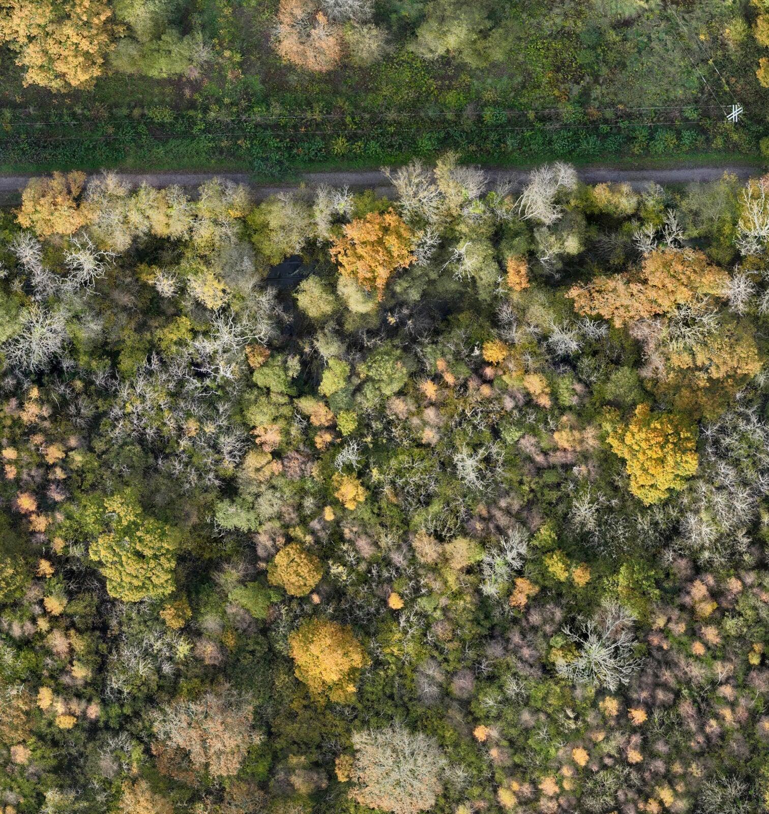
DigiRotor Maps
DigiRotor Canopy (Beta) - Our cloud based in house mapping software
Canopy will offer a complete turn key solution to organisations who want to securely store, process, annotate and use maps. We can support organisations of almost any size, no client is too small or too big.
Canopy is currently in beta testing with a small number of trusted partners, if you are interested in learning more please contact us.
Canopy makes use of multiple open and closed sources products, which we have integrated into a seamless pipeline and workflow.
Here are some of the ways Canopy can be used to solve your organisations mapping and operational challenges:
Mapping a variety of work areas and sites
From demolition to nature preservation, we are working with partners to explore how Canopy can be used to help organisations plan and operate more effectively whilst extracting the maximum insight and information they can about an area
Markup and share with everyone working on a site or project
Our drone maps can be uploaded to Canopy. Within the tool you can markup, draw, make notes and gain feedback from those working on site. You can collaborate together at any time, from anywhere in the world, securely.
Helping on site teams find their way
Large, complex or confusing sites can now be navigated much more easily. Using any mobile or tablet device with GPS, on site teams can see their current position and easily navigate to where works are required. On site teams can update the data in Canopy with real time information relating to progress of works or issues, allowing back office and management to see progress and help resolve challenges in real time
Identify plants, trees and infrastructure at risk
Our drones feature highly sophisticated cameras which are able to gather information regarding the health and vitality of plants, we can calculate chlorophyll content, nitrogen uptake and identify private and public infrastructure at risk from potentially diseased tress - allowing you and your clients to take action before risks are realised. This functionality is out of the box, and requires very limited training to operate.
3D Captures
We can use Canopy to create 3D twins or models of real life objects, buildings or even spaces. Not only can these models be viewed and annotated within Canopy, but we can also print scaled physical replicas. These can be used to show clients progress, for planning purposes or just as something cool to have on display!
Beta Testers Wanted
We are open to working with organisations of any size across a variety of sectors, but are particularly interested in those within the following industries:
- Land care
- Arb & Tree Care
- Large scale landscape developers
- Organisations responsible for looking after our natural spaces
- Demolition and related industries
If you'd like to know more please contact us and we will setup a call to run through what we can offer